Coyotes in Cleveland National Forest

"An incorporated town will have a mayor and/or city council and some semblance of self-government. An un-incorporated town will have no self-ruling government established and is usually just a named location (usually governed over by the larger political division in which it is located) within a county."

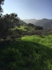
Again, it's only 1 mile from city limits and if your in CNF, you should be able to get that far off. Just sucks because the edges of communities backing to CNF have mega coyote populations but you're shotguning at 150 yards or rifle at 1 mile.

This is a list of incorporated cities in Riverside County. This is from Wikipidia and should NOT be used to determine LEGAL hunting locations. This can be used to know where NOT to hunt.

If you're technically in Corona, then it's a mile. If it's Temescal Valley, you should be good. Just make sure you know for sure before going. You hold the responsibility to bear the knowledge. When in doubt, slug it out. I was shooting "rifled" slugs out of my shotgun (smooth bore Remi 870) the other day hitting a 12" steel target at 175-200 yards. Might be a viable option.

Banning
Beaumont
Blythe
Calimesa
Canyon Lake
Cathedral City
Coachella
Corona
Desert Hot Springs
Eastvale
Hemet
Indian Wells
Indio
Jurupa Valley
Lake Elsinore
La Quinta
Menifee
Moreno Valley
Murrieta
Norco
Palm Desert
Palm Springs
Perris
Rancho Mirage
Riverside
San Jacinto
Temecula
Wildomar
 
Their is a map somewhere that shows where it's legal to hunt with what weapon. Look it up under the county web site or call the sheriff or game wardens they will be able to get you going.
 
MJB said:
Their is a map somewhere that shows where it's legal to hunt with what weapon. Look it up under the county web site or call the sheriff or game wardens they will be able to get you going.

everything I've seen online is either some dude's rendering off Google Earth or you have to pay $50 for them. Might want to try to call the Riverside County Sherriff department but from past experience, it's difficult to find anyone who actually has the knowledge. The Riverside County website doesn't have anything easily accessible under their search tool. I just went through it for a few minutes and couldn't find it easily. Give it a shot. Let me know if you find anything worth while.
 
Try the sheriff web site they have it if I remember correctly or call the game warden I use to have one of their numbers.
 
The city I live in is Temescal Valley. We annexed from Corona last year.
When I took my hunter safety course out at Raahauges in September I specifically asked them about this area. I was surprised when they said 150yrds from any building or road.
Sounds like the typical California BS, no body knows for sure because nobody wants to take responsibility.


Oath Keeper
 
MJB said:
Try the sheriff web site they have it if I remember correctly or call the game warden I use to have one of their numbers.

Thanks for the tips MJB. All the RivCo Sherriff dept provides is links to the Barstow shotgun map and references to BLM maps but nothing that shows good boundaries for different firearms. Those aren't going to help him.

Mr. Denton, either get a mile out, get a shotgun, or go further south into Temescal Canyon which may not be incorporated (I know they were talking about incorporating it into Corona but I don't think that's happened yet). Your opportunities for open hunting areas gets more limited as you move south and the mountains get more vertical and the foothills are either mine owned or private communities. Further North, you're in the same problem with the city of Corona and a park / sanctuary. Honey holes are very difficult to find around us because of the limited space and public shared use of the land. My suggestion is to get a map and mark off spots that are definite no-go's. Once you've eliminated where you CAN'T go, it'll open up where you possibly CAN go. You can always go east, north, or south. We're similar to hunters who live in OC but we actually have a few spots we can hunt. My 2 cents is all spent up.
 
MrDenton said:
The city I live in is Temescal Valley. We annexed from Corona last year.
When I took my hunter safety course out at Raahauges in September I specifically asked them about this area. I was surprised when they said 150yrds from any building or road.
Sounds like the typical California BS, no body knows for sure because nobody wants to take responsibility.


Oath Keeper

If you're in Temescal Valley, you should be legit. The good thing about county regs is that the only people who know them and actually stick to them are ourselves (IN MY EXPERIENCE). If it's a "grey" location, you have less to worry about.
 
http://www.rivcocob.org/ords/500/514.10.pdf

here is the riverside ord 514. its a semi simple read. that is hurdle one.

the next is what ever city codes you have to follow. If temescal valley was annexed by corona then anything inside that is a NO GO.
9.48.010 Discharging – Prohibition.
Except as provided in § 9.48.020, no person shall shoot or discharge any pistol, revolver, gun or other firearm within the city, except in necessary self-defense or in the performance of official duty as a peace officer.
http://www.amlegal.com/library/ca/corona.shtml
 
The 150 rule is correct for some areas I gave steel the number to local warden who should be able to help......I also think Jho has the map on their site
 
http://www.calguns.net/calgunforum/showthread.php?t=388656

Did anyone do search?
This popped up
 
Aeon said:
http://www.rivcocob.org/ords/500/514.10.pdf

here is the riverside ord 514. its a semi simple read. that is hurdle one.

the next is what ever city codes you have to follow. If temescal valley was annexed by corona then anything inside that is a NO GO.
9.48.010 Discharging – Prohibition.
Except as provided in § 9.48.020, no person shall shoot or discharge any pistol, revolver, gun or other firearm within the city, except in necessary self-defense or in the performance of official duty as a peace officer.
http://www.amlegal.com/library/ca/corona.shtml

Once you're in the Nat Forest, wouldn't city codes become obsolete? Otherwise it wouldn't be Nat Forest, correct?
 
MJB said:
http://www.calguns.net/calgunforum/showthread.php?t=388656

Did anyone do search?
This popped up

My phone isn't openkng it but I think it's the same one I saw. Some guy just made that in 2006 on Google Earth. Wouldn't bet legality on that but info is info.
 
Thank you all for all the info. I took a little walk today.
Started out at the edge of our neighborhood and hiked in 1 mile with a 900' climb. All dog signs vanished after 1/2 mile. Inside the 1/2 mile there was scat and tracks everywhere. Even found some tall grass that something had bedded down last night.
I took my rangefinder, most spots that looked doable weren't any further than 125yrds. Majority were less than 75yrds. Completely acceptable if I need to lug my 870 12ga up there.
Sign
e55030fd4e28185b4f7c708a310f129e.jpgfe0d836329228b0a5de8570dc0c45f72.jpgaf0bed44cdcf47c589eb5826550f6764.jpg
Potential kill zones
0acad040c4ae48d7274ad529b5f506a6.jpg23e22cc5b3954f38e1b939b1069845c3.jpg


Oath Keeper
 

Attachments

  • e55030fd4e28185b4f7c708a310f129e.jpg
    e55030fd4e28185b4f7c708a310f129e.jpg
    619.3 KB · Views: 1
  • fe0d836329228b0a5de8570dc0c45f72.jpg
    fe0d836329228b0a5de8570dc0c45f72.jpg
    615.7 KB · Views: 1
  • af0bed44cdcf47c589eb5826550f6764.jpg
    af0bed44cdcf47c589eb5826550f6764.jpg
    632.9 KB · Views: 1
  • 0acad040c4ae48d7274ad529b5f506a6.jpg
    0acad040c4ae48d7274ad529b5f506a6.jpg
    293.2 KB · Views: 1
  • 23e22cc5b3954f38e1b939b1069845c3.jpg
    23e22cc5b3954f38e1b939b1069845c3.jpg
    318.2 KB · Views: 1
I dropped pins at each spot. The furthest one out was approx 1 mile, 1,980' elevation and no signs of dogs. 9d2660f3031858a0edb7702decb5cdee.jpg


Oath Keeper
 

Attachments

  • 9d2660f3031858a0edb7702decb5cdee.jpg
    9d2660f3031858a0edb7702decb5cdee.jpg
    384 KB · Views: 1
That's our typical problem here. They stay too close to communities. You almost have to try to entice them UP to the CNF. Harder than it seems cuz they'll scent you off the trail before coming to you most times. Hit me up if you want to go for a local hunt. Keep scouting your areas. Did you see any signs of rabbit up at the 1 mile mark?
 
All the grass is real soft and green from the rains. It's probably a foot tall and there were little beat down trails everywhere.


Oath Keeper
 
Careful with the area that you were scouting. Looked it up on caltopo dot com maps and trimbles gps hunt pro it looks to be private land. A friend and I are planning to go and scout the area of hwy74 and main dived rd. on Sunday. You are more then welcome to come if interested.
 
That'd be awesome but I'm demoing my kitchen this weekend. Remodel starts Monday. Bought this today. ceba0f410b184ef78a5ca88257f16629.jpg
You're right, it looks like the CNF boundary isn't at the edge of the forest.


Oath Keeper
 

Attachments

  • ceba0f410b184ef78a5ca88257f16629.jpg
    ceba0f410b184ef78a5ca88257f16629.jpg
    234 KB · Views: 1

About us

  • SCHoutdoors was created in January of 2011 by a few people who love the outdoors. The main goal is still the same – bring people together who enjoy the outdoors and share their knowledge and experience.
    Outdoors in the West, Hunting gear reviews, Big Game, Small Game, Upland Game, Waterfowl, Varmint, Bow Hunting, long Range Rifles, Reloading, Taxidermy, Salt WaterFishing, Freshwater Fishing, Buy-Sell-Trade on Classifieds and Cooking/Recipes
    All things outdoors…come join us, learn, contribute and become part of the SCHoutdoors community.

Quick Navigation

User Menu