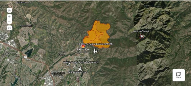
sorry to say it but the D15 is on fire...again. Anyone know where Larry is at?
 www.fire.ca.gov

Incidents | CAL FIRE


100%, Holy Jim fire was ~4 years before a limited "reopening"Right on the evac line
Lots of fuel, this is what its heading into right now. What do you think 3-5 year closure.

Right on the evac line
View attachment 62921
Lots of fuel, this is what its heading into right now. What do you think 3-5 year closure.
View attachment 62922
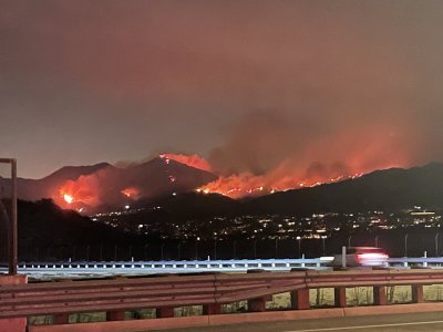
Taken as of 9pm on my way home from work at Chiquita and los patrones, active areas appear to be bell view ridge trail on the southern edge, Santiago peak (shown in the center) and the lower elevation shown on the left which I assume is north side of Trabuco creek drainave.. no vis from this vantage deeper into the drainage but assume that’s cooking
View attachment 62933
Time to start looking for a new spot if it's any where close to the burn. Here's the closure map from the 2018 Holy fire which burned the same general area. The area in yellow stayed closed from 2018 through 2021.This will be my first year hunting D15. Had a good spot picked out so I’m hoping it doesn’t get destroyed. How has the forest service handled closures and hunting season in the past after a season like this?
as of right now the spot is 5 miles away and opposite direction of the wind is blowing so I’m crossing my fingers. Just hoping they don’t shut down the area if it gets close to the spot.Time to start looking for a new spot if it's any where close to the burn. Here's the closure map from the 2018 Holy fire which burned the same general area. The area in yellow stayed closed from 2018 through 2021.

